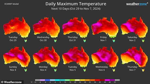
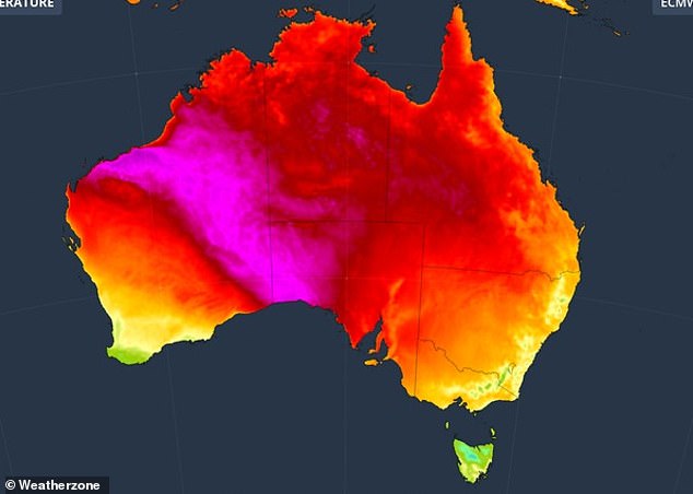
Australia has been warned of a heatwave set to hit parts of the country over the weekend with a major weather system producing above-average temperatures.
A high pressure system forming in the southern part of the country will unleash a mass of warm air across northern Australia over the next few days.
A cold front will then extend across southern Australia, pulling warm air towards the east coast.
The Bureau of Meteorology has issued a warning for strong gusts of wind expected to hit parts of New South Wales, Victoria and Queensland until the end of Wednesday.
Parts of southern Australia are likely to experience dry conditions before the cold front establishes itself.
Weatherzone meteorologist Corine Brown told Daily Mail Australia the combination of hot and cold weather is producing the latest heatwave.
“The pressure difference between the high front and the cold front… is what will draw that heat inland towards Adelaide, Canberra and Sydney,” Ms Brown said.
“The high pressure system is going to remain stubborn for several days, allowing heat to build up.”
A high pressure system forming in the southern part of the country will unleash a mass of warm air across northern Australia over the next few days.
Brown said temperatures in Melbourne, Canberra and Sydney will peak over the weekend.
“For Sydney… there is a chance of a sea breeze coming in that will keep temperatures below 30 degrees,” he said.
“Outer west Sydney has a good chance of seeing (temperatures) around 35 degrees.”
brisbane
Wednesday: Possible shower. Min 19. Max 27.
Thursday: Possible shower. Min 19. Max 31.
Friday: Shower or two. Min 19. Max 31.
Sydney
Wednesday: Mostly sunny. Min 15. Max 25.
Thursday: Sunny morning. Shower or two. Min 15. Max 25.
Friday: Shower or two. Min 16. Max 23.

Weatherzone meteorologist Corine Brown said the combination of warm and cold weather is producing the latest heatwave.
Melbourne
Wednesday: Partly cloudy. Min 11. Max 21.
Thursday: Shower or two. Min 12. Max 19.
Friday: Cloudy. Min 11. Max 17.
Canberra
Wednesday: Cloud clearing. Min 7. Max 27.
Thursday: Partly cloudy. Min. 6. Max. 25.
Friday: Partly cloudy. Min 7. Max 23.

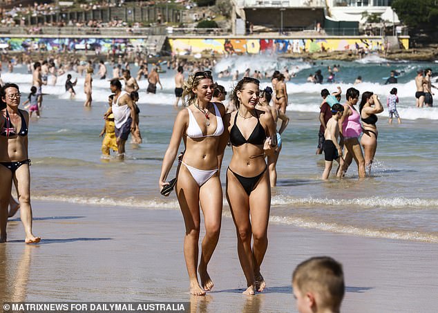
Next, a cold front will pass through southern Australia and drag warm air towards the east coast (pictured, visitors on a Sydney beach)
hobart
Wednesday: Partly cloudy. Min 10. Max 18.
Thursday: Showers. Min 10. Max 15.
Friday: Shower or two. Min. 8. Max. 15.
Adelaide
Wednesday: Sunny. Min 11. Max 26.
Thursday: Mostly sunny. Min 12. Max 24.
Friday: Mostly sunny. Min 11. Max 24.

Ms Brown said heat will exceed 30 degrees in western Sydney, while temperatures will remain moderate in Melbourne and Canberra over the next few days.
Perth
Wednesday: Sunny. Min 15. Max 31.
Thursday: Sunny. Min 15. Max 33.
Friday: Mostly sunny. Min 16. Max 28.
Darwin
Wednesday: Shower or two. Possible storm. Min 27. Max 35.
Thursday: Shower or two. Min 27. Max 34.
Friday: Shower or two. Min 26. Max 33.

