<!–
<!–
<!– <!–
<!–
<!–
<!–
Millions of Australians have been warned that bad weather will add to travel delays due to last week’s deluge.
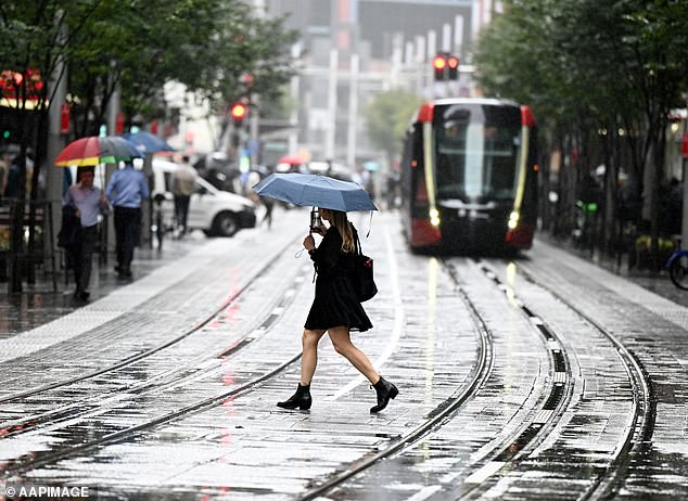
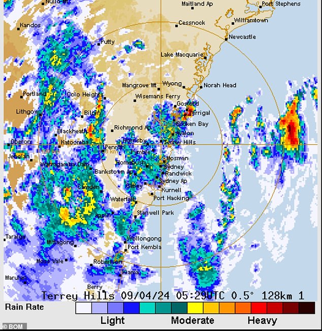
Sydney commuters should expect transport chaos when a massive rain bomb dumps between 4 and 15mm of rain across the city on Tuesday afternoon.
The Bureau of Meteorology warned coastal communities from Sydney to Coffs Harbor to prepare for gale-force winds.
The Bureau also warned of dangerous surf conditions from Sydney to Forster and urged against activities such as rock fishing.
It comes just as communities began the grueling task of cleaning up after a monster storm hit the East Coast on Friday.

Sydneysiders will be hit by another storm on Tuesday afternoon, potentially causing more chaos for commuters after last weekend’s deluge damaged roads and railways.
The clean-up effort also limited public transport routes for Sydney commuters on Tuesday morning, forcing Transport NSW to urge thousands of people to work from home.
Tracks needed to be repaired in several locations in and around Sydney after the deluge caused landslides that damaged rail infrastructure.
Up to 250 Sydney Trains workers are expected to begin carrying out those repairs, but track work is expected to cause delays.
“Passengers should allow extra travel time, check signage boards, listen to station announcements and plan their journey in advance,” a statement from Transport NSW reads.
‘Sydney Trains thanks passengers for their patience as we work to recover the network.’
Railway tracks along the line at Bomaderry, Port Kembla and Coalcliff Yard were flooded, damaged or covered in debris on Tuesday morning.
Services on the South Coast Line to Port Kembla and Kiama have resumed, but with a reduced weekend schedule.
“Buses are replacing trains between Bomaderry and Kiama as we work to restore services,” Sydney Trains wrote in X.
Those driving through the city should also “exercise caution” as heavy rainfall could have damaged some roads or caused potholes.
The warnings come after more than a month of rain fell on Sydney, Port Macquarie and Taree on Friday, delaying trains, cutting power and prompting evacuation alerts.
The New South Wales State Emergency Service was involved in more than 70 flood rescues in the Sydney metropolitan area as of Saturday morning and had received more than 4,000 calls in 24 hours.


Train tracks along Sydney’s South Coast Line were seen partially underwater or severely damaged by the weekend deluge.


The rain is expected to be followed by gale-force winds and dangerous surf conditions along the east coast.
New South Wales Police confirmed a body was found in flooded waters west of Sydney after the torrential downpour.
Emergency services were called to King St in Penrith at around 7.45am on Saturday morning, after a member of the public reported the body of a man in the water near a reservoir.
A NSW Police statement said officers from Nepean Police Area Command had established the crime scene and said the man has not yet been formally identified.
Friday’s monster storm also destroyed the only road into Megalong Valley, a small town west of Katoomba in the Blue Mountains.
About 200 residents and visitors managed to evacuate Sunday night across private property, helped by an excavator that cleared the way.
Those who stayed to support the city are now eagerly awaiting a temporary solution to the broken road and reconnecting the city.
Meanwhile, the Rural Fire Service will continue to airdrop food, essential supplies and food into the city.
