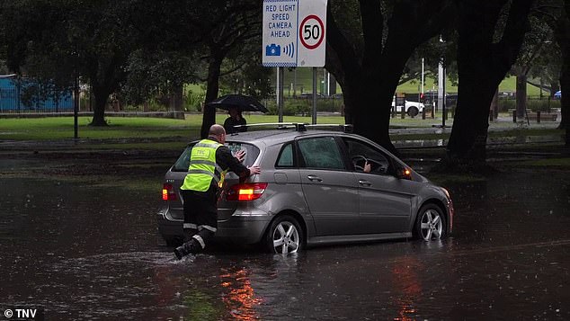
- More than a month of rain fell on Sydney
- About 171 mm recorded in Rose Bay
After receiving more than a month of rain in less than a day, Sydneysiders can finally put away their umbrellas and enjoy the sunshine.
However, flood warnings remain in force around the Hunter area, with minor flooding in the Williams River and moderate flooding in the Wollombi Brook River, BOM senior meteorologist Dean Narramore said on Sunday.
Narramore said dangerous surf and beach conditions would also continue into Monday in southern and central coastal areas of New South Wales.
This comes after rain lashed the state on Saturday, with persistent moderate to heavy rain across the Sydney and Hunter areas.
Narramore said the heaviest rainfall on Saturday was around Sydney, with 171mm of rain in Rose Bay, 159mm in Little Bay and 143mm in the city itself.
After receiving more than a month of rain in less than a day, Sydneysiders can finally put away their umbrellas and enjoy the sunshine (pictured flooding Lewisham station in Sydney’s inner west)

Narramore said Saturday’s heaviest rainfall occurred around Sydney, with 171mm of rain in Rose Bay, 159mm in Little Bay and 143mm in the city itself.
“To put it in perspective, their monthly average for June is 132 mm,” Narramore said.
“So many of our eastern Sydney suburbs saw a month’s worth of rain in just 12 to 18 hours.”
Narramore said the heavy rain had been caused by a large band of rain that had moved across the country in recent days and developed into a low pressure system offshore on Saturday, pushing some of the rain toward Sydney’s coastal areas. Central Coast and Hunter Districts.
“That low has now continued to move away, so we’ve seen rain and shower activity decrease in the Sydney area and rain continues in the Hunter,” Mr Narramore said.
“But all that should be gone by Sunday night for a sunny Monday across much of New South Wales.”
While the rain had mostly eased in Sydney by Sunday morning, Narramore said there could be some “lighter and more isolated” coastal showers.
On the other side of the country, residents have also been using their umbrellas after a strong cold front hit western WA on Saturday night.
“This brought heavy rain, damaging winds and severe thunderstorms,” Mr Narramore said.
‘We have a current severe weather alert from Kalbarri to Albany

While the rain had mostly eased in Sydney by Sunday morning, Narramore said there could be some “lighter and more isolated” coastal showers.
“That includes places like Perth, Bunbury and extends to parts of the central wheatbelt hinterland and the great south.”
Narramore said there had been widespread rainfall of 30 to 50mm, including 42mm in Perth and wind gusts of more than 100km/h on Rottnest Island.
On Sunday, WA’s cold front is likely to continue moving inland, while conditions begin to improve along the coastal belt and southwest, Narramore said.
But it will still be a windy day, with showers that may contain local hail and thunder, as well as large waves and swell, particularly in southwestern parts of WA.
A warning for strong to gale-force winds remains in place for some coastal waters, with a warning for sheep herders in the lower west and south-west districts.


