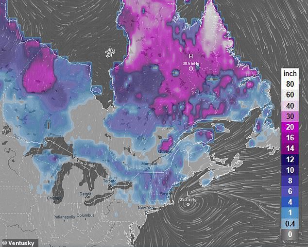
According to forecasters, the Great Lakes, the interior Northeast and New England will see heavy snowfall by the middle of this week.
From California, the spring storm system responsible for the snow forecast already caused a downpour in San Diego on Saturday. Nearly 50 million people across the county are preparing for unseasonable weather.
“We’re looking at Wednesday or Thursday, looking at the potential for up to 3 inches of rain in the mid-Atlantic,” FOX Weather meteorologist Craig Herrera said.
“The big snow event could be happening across New England.”
FOX Weather predicts the storm will reorganize on the eastern flank of the Rocky Mountains on Monday, bringing with it warm, moist air that fuels the potential for severe thunderstorms and tornadoes over the central United States.
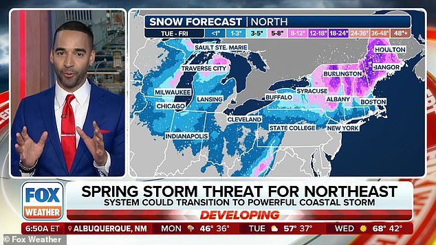
According to forecasters, the Great Lakes, the interior Northeast and New England will see heavy snowfall by the middle of this week.
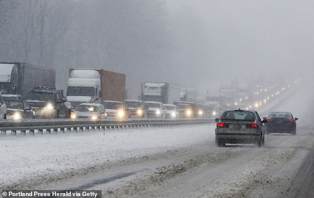

From California, the spring storm system responsible for the snow forecast already caused a downpour in San Diego on Saturday
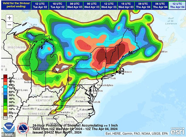

Experts predict the storm will reorganize on the eastern flank of the Rocky Mountains on Monday, bringing with it warm, moist air that fuels the potential for severe thunderstorms and tornadoes over the central United States.
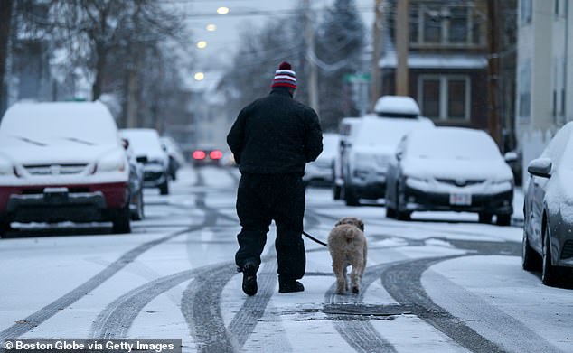

In Chicago and Detroit, the storm may still be in the warm phase on Wednesday as it moves through the Great Lakes and the Northeast.
In Chicago and Detroit, the storm may still be in the warm phase on Wednesday as it moves through the Great Lakes and the Northeast.
As cold air moves inland, Michigan and Wisconsin will turn wintry. Tuesday night’s rain will turn to sleet, which will eventually turn to freezing rain and snow.
Rain is expected in Syracuse and Boston ahead of the storm, and snowfall is expected at higher elevations in Vermont and New Hampshire.
“Tuesday’s active weather will only be Round 1 as the stationary front begins to break down,” Herrera said.
‘As we move into Wednesday, the main low will begin to persist around the Great Lakes. It is at this moment when the prognosis becomes complicated.
‘The evolution of the coastal low remains unclear, but all indications suggest that it will greatly increase rain, snow and wind on Wednesday and Thursday.
“The track and strength of the coastal low will ultimately determine the severity of impacts along the I-95 corridor, as well as the amount of snow that will fall in New England.”
On Tuesday, rain is expected to reach much of the Midwest and Northeast.
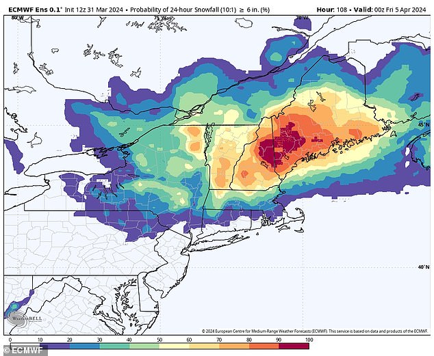

As cold air moves inland, Michigan and Wisconsin will turn wintry; Tuesday night’s rain will turn to sleet, which will eventually turn to freezing rain and snow.
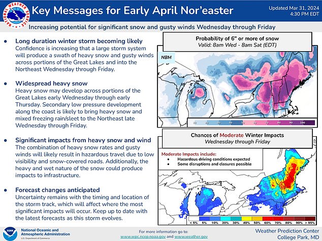

In the photo: Key messages for the long-awaited Northeast Easter
The Ohio Valley and Appalachians are under a severe weather warning that could produce tornadoes, hail and devastating winds.
Snow is forecast to mix across the Midwest and Great Lakes by the end of the day. Before the snow accumulates, Michigan residents are advised to prepare for a highly dangerous period of sleet and freezing rain for their Tuesday night commute.
There is a danger of flash flooding through Wednesday in the Ohio Valley and Mid-Atlantic, where some locations may receive two to three inches of rain.
The timing of the heavy snow is still uncertain, according to the FOX Weather Center, which said it could begin Tuesday night or wait until Wednesday.
The coastal storm is expected to take shape near the mid-Atlantic on Wednesday.
‘What does that do?’ Herrera said. “Well, right now it looks like it’s heading toward the coast, and then we could be talking about a lot of winds coming out of the northeast, and we could have to deal with some snow in parts of New England and some heavy rain.”
As for where and how strong the low will be, computer weather models have not yet determined the details, but will be adjusted for accuracy closer to Wednesday.
The FOX Forecast Center said a low could become a major coastal storm, which could mean more heavy rain, snow and strong winds closer to the Interstate 95 corridor.
Gusty winds and snow are expected to hit much of the Northeast on Thursday. If the depression continues off the New England coast, we could be looking to the northeast.
Over the weekend, a powerful Easter storm system issued flash flood warnings across much of Los Angeles County and heavy rain across the rest of California and the heartland, affecting an estimated 50 million Americans. .
Forecast models showed widespread severe weather will hit the center of the county on Monday before heading east into Tennessee and Ohio.
Storms can cause dangerously strong gusts of wind, as well as lightning and tornadoes.
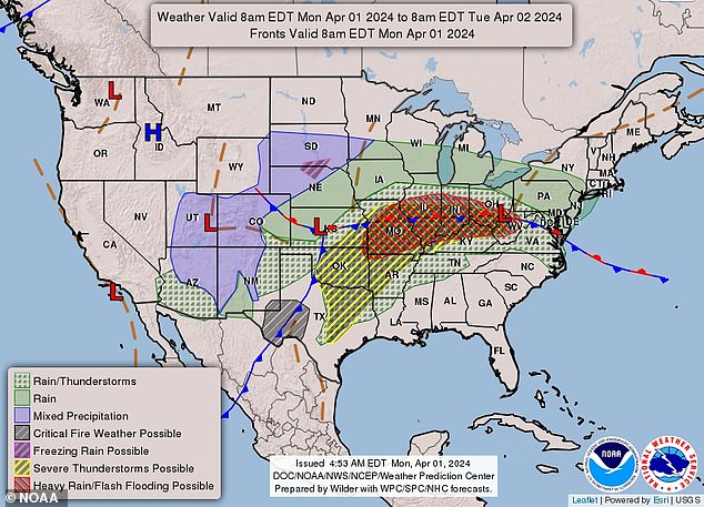

Rain is expected in Syracuse and Boston ahead of the storm, and snowfall is expected at higher elevations in Vermont and New Hampshire.
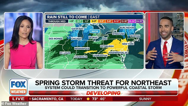

Snow is forecast to mix across the Midwest and Great Lakes by the end of the day.
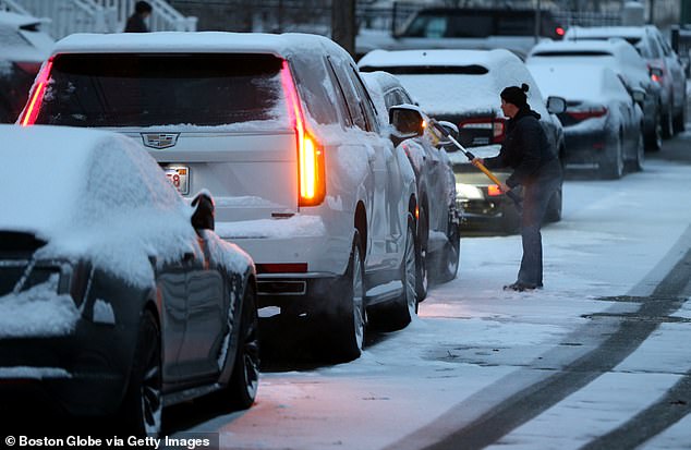

The timing of the heavy snowfall is still uncertain as it could begin Tuesday night or wait until Wednesday.

NOAA’s Storm Prediction Center said that on Monday, states like Oklahoma could experience hail 2 inches wide.
FOX Weather meteorologist Jane Minar said: ‘What starts in the West must eventually come to the East. “All that energy, as it moves over the Four Corners over the weekend, takes on a second life as it unfolds in the middle of America.”
NOAA’s Storm Prediction Center said that on Monday, states like Oklahoma could experience hail 2 inches wide.
Some of the tornadoes, the organization warns, could occur during Monday night. Nighttime tornadoes are more than twice as likely to cause fatalities.

