A powerful blast of cold air from Antarctica has plunged much of the country into winter-like chill, but warmer weather is on the way later this week.
This weather system has brought below-average temperatures to Tasmania, Victoria, New South Wales, South Australia and Queensland.
“Right now, we have a high pressure system that’s basically blocking all that cold air over Australia and circulating it,” he explained. Weather zone meteorologist Maryam Al-Ansari.
‘And that’s why we’re seeing such cold temperatures right now.
‘High pressure systems generally mean the air is super stable, we don’t have those clouds at night that can insulate the Earth from moving all of its daytime heat.
‘So we have very cold nights and we wake up to frost.’
Most of Australia will be shivering for the next two days before the weather starts to warm up (pictured: travellers bundled up)
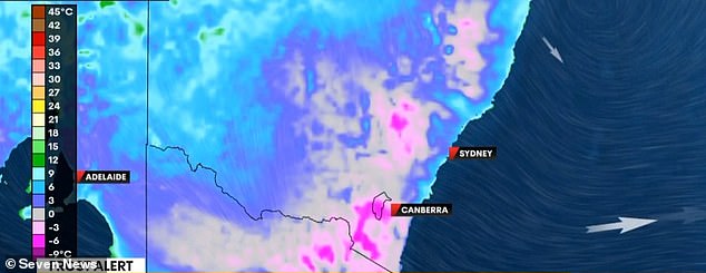
The cold front is due to Antarctic air from last week being trapped in a high pressure system, which causes it to circulate across most of the country (weather map in the image)
Sydney is set to remain cold for the next two days. On Tuesday morning, the city recorded temperatures of 9.3°C, while in outer suburbs such as Campbelltown temperatures dropped to just 3°C.
The mercury will rise on Thursday, creating ideal conditions for forest fires.
“Right now, we’re starting to see winds pick up as high pressure moves eastward; that movement will start to bring heat from central Australia.”
“We have an extreme fire danger rating,” Ms. Al-Ansari said.
“We are expecting temperatures of between 20°C and 25°C on Thursday and that will be accompanied by an increase in wind speeds as well.”
Melbourne has been warmer than other east coast cities due to its cloud cover combined with northerly winds, but could experience some scattered showers.
The high pressure system will reach Brisbane today, creating strong winds along the coast.
However, temperatures are expected to rise and possibly reach 30°C on Sunday.
“We’ll see more cloud cover and it will be 2°C cooler than average for this time of year, but temperatures look set to rise over the weekend,” Al-Ansari said.
But cold weather has hit Tasmania, with Tuesday morning’s 8.7C feeling like 1C due to “quite intense” wind gusts over Tasmania.
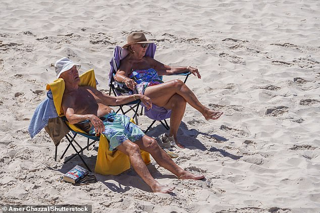
Perth is not experiencing the cold temperatures of the high pressure system (file photo of people on the beach)
While other cities will begin to warm up over the next two days, Canberra will remain cold. A new cold front arriving on Thursday will push temperatures even lower.
On Tuesday morning, temperatures in Canberra dropped to a freezing -2.4°C, and on Wednesday morning they are expected to be around 0°C.
Perth is experiencing higher than average temperatures, but they are expected to drop next week.
Meanwhile, Darwin continues its typical tropical weather pattern ahead of the rainy season, with temperatures reaching over 30°C this week.
Brisbane
Tuesday: Mostly sunny. Light winds from the east at 15 to 20 km/h in the early afternoon, then becoming light in the evening. Max. 24.
Wednesday: Partly cloudy. Possibility of fog in the early morning. Light winds from the north to northeast at 15 to 25 km/h in the afternoon. Min. 13 Max. 25.
Thursday: Partly cloudy. Light winds from the northwest at 15 to 20 km/h in the morning and then from the north at 15 to 25 km/h in the afternoon. Minimum 13 Maximum 29.
Sydney
Tuesday: Sunny. Light winds, tending to the northeast at 15 to 20 km/h near the coast in the afternoon. Max. 22.
Wednesday: Sunny. Light west to northwest winds at 20 to 30 km/h in the morning then light in the afternoon. Min. 9 Max. 27.
Thursday: Sunny. Northwest winds at 25 to 35 km/h, becoming west at 25 to 40 km/h during the day and then light at night. Min. 14 Max. 27.
Melbourne
Tuesday: Cloudy in the morning, with sunny patches forming in the afternoon. Chance of light rain in the morning. Winds from the west at 15 to 25 km/h, becoming weak in the afternoon and from the north to northwest at 15 to 20 km/h in the afternoon. Max. 17.
Wednesday: Mostly sunny day. Medium chance of showers, more likely at night. Winds from the north to the northwest at 20 to 30 km/h, tending to the west to the northwest at 30 to 45 km/h during the day. Minimum 8 Maximum 20.
Thursday: Partly cloudy. High chance of rain. Westerly winds at 25 to 40 km/h. Low 10 High 17.
Adelaide
Tuesday: Sunny. West to northwest winds at 15 to 20 km/h, easing in the afternoon. Max. 19.
Wednesday: Sunny. Winds from the north at 15 to 20 km/h, turning to the west at 25 to 40 km/h at noon. Minimum 8 Maximum 22.
Thursday: Cloudy. Medium chance of rain. Winds from west to northwest at 15 to 20 km/h tending to west to southwest at 25 to 35 km/h during the morning. Minimum 11 Maximum 17.
Perth
Tuesday: Sunny. Winds from the north to the northeast at 15 to 20 km/h, turning to the west to the northwest at noon and then to the southeast to the southwest in the late afternoon. Max. 27.
Wednesday: Sunny. Light winds from the south at 20 to 30 km/h at noon and from the southeast at 15 to 25 km/h in the afternoon. Min. 11 Max. 24.
Thursday: Mostly sunny. Winds east to southeast at 20 to 30 km/h turning south to southeast at 15 to 25 km/h during the day. Low 10 High 23.
Hobart
Tuesday: Mostly cloudy. Chance of light showers. Northwest winds at 25 to 35 km/h. Max. 14.
Wednesday: Cloudy. High chance of showers, most likely in the morning and afternoon. Possible small hail in the afternoon and evening. Winds west to northwest at 30 to 45 km/h. Min. 9 Max. 15
Thursday: Cloudy. High chance of showers, most likely in the morning and afternoon. Small hail possible in the afternoon and evening. Northwest winds at 20 to 30 km/h increasing to 30 to 45 km/h during the morning and then west at 25 to 35 km/h during the afternoon. Min 5 Max 13.
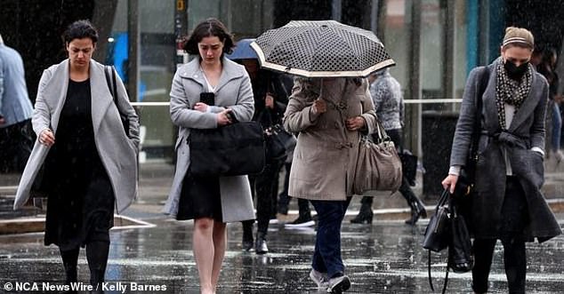
There is a high chance of rain this week in Hobart, combined with very cold temperatures (file photo of people walking in the rain)
Darwin
Tuesday: Partly cloudy. High chance of showers, decreasing towards morning. Chance of thunderstorms early this morning. Winds southeast at 15 to 25 km/h, easing at night. Max. 31.
Wednesday: Partly cloudy. Medium chance of showers. Winds southeast at 15 to 25 km/h, turning to east at 20 to 30 km/h in the morning and then light in the evening. Min. 23 Max. 32.
Thursday: Partly cloudy. Medium chance of showers, most likely in the morning. Winds east at 15 to 25 km/h turning to northeast during the day. Min. 25 Max. 33.
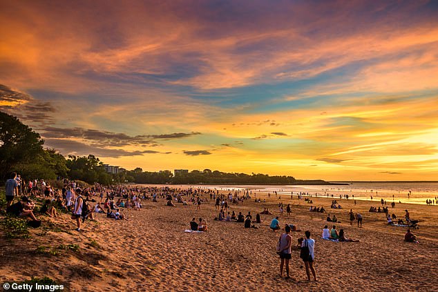
Darwin continues to have its own tropical weather system and will experience days of temperatures in the 30s this week (pictured: Mindil Beach, Darwin)
Canberra
Tuesday: Sunny. Northwest winds at 15 to 25 km/h, becoming west at 20 to 30 km/h at noon and then light in the evening. Max. 19.
Wednesday: Sunny. Frost in the early morning. Winds from the northwest at 20 to 30 km/h, becoming west-northwest at 30 to 45 km/h in the morning and then northwest at 20 to 30 km/h in the afternoon. Min. 2 Max. 18.
Thursday: Partly cloudy. Slight chance of showers in the afternoon. Northwest winds at 30 to 45 km/h becoming west at 20 to 30 km/h overnight. Low 5 High 18.


