Parts of Australia are expected to be in sweltering heat this week as a heatwave moves through the southeast, with one state already battling serious bushfires.
Melbourne could reach temperatures as high as 37C on Wednesday, while Adelaide could see a day as hot as 33C, and Sydney could see highs of 36C on Thursday.
A cool change is forecast to bring respite to residents of Melbourne and Adelaide late on Wednesday night.
Meanwhile, Victorians have been told to flee fire danger zones while they can, as catastrophic and extreme level warnings consume some areas in the state’s west.
The Bayindeen bushfire, northwest of Ballarat, was still burning on Wednesday after authorities released a map showing the fire could burn through areas including Beaufort, Elmhurst, Amphitheatre, Lexton, Learmonth and Clunes.
Residents in the area received a text message on Tuesday urging them to leave the area before noon.
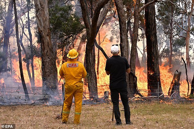
A fire is seen burning in Raglan, Victoria last week. Meanwhile, Victorians have been told to flee fire danger zones while they can.
Predicted temperatures around 30 degrees and wind gusts of up to 80 km/h in the area were expected to fan the flames.
As of Tuesday, the fire had devastated more than 21,300 hectares.
Residents were warned to leave Wednesday morning, while those in regions with extreme fire danger were also told to flee.
Areas with an extreme fire danger rating on Wednesday were the Mallee, Northern Country, North Central, Central and South West regions.
Mildura was expected to reach 44C and other areas were also expected to reach 40C before a cold shift approached central parts of Victoria after 8pm.
Residents fleeing dangerous areas were urged to head to built-up areas such as Ballarat, Ararat and Maryborough.
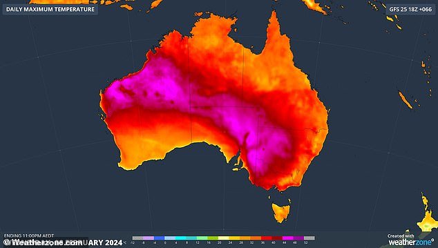

The final days of summer are expected to bring a wild mix of weather across Australia, including widespread rain and thunderstorms, sweltering heatwaves and dangerous fire conditions (pictured Wednesday).
Victoria Police strategic commander Jason Templar told a Pyrenees Shire Council meeting in Beaufort on Tuesday afternoon that rapid deployment teams would be ready to close roads at the request of the incident controller on Wednesday.
“The message about leaving and leaving early is very important because once those roads close, that’s it,” he said Tuesday.
“Today or early tomorrow is the time to get out… and the reason we close them is purely for public safety, it’s too dangerous to be on those roads.”
The Beaufort urgent care center was closed Wednesday and the Bayindeen wildfire threatened to knock out power to homes if it reached the Western Highway.
“Pyrenees Shire Council Mayor Robert Vance warned his constituents: ‘this beast is a reality.’
“When the beast is gone (and) passed out, we will be there to help everyone,” he said.
About 500 firefighters were again expected to be on the ground, with more than 60 aircraft ready to fight the blaze and any new fires.
The New South Wales Rural Fire Service, which has deployed 25 fire engines and 110 of its own firefighters to help fight the Bayindeen fire, has additional aircraft on standby near the Victorian border.
Extreme fire danger was also expected for much of eastern South Australia on Wednesday, with Emergency Services Minister Joe Szakacs warning the state’s firefighters were facing some of the toughest weather conditions this summer.
Seven South Australian districts had an extreme fire danger rating on Wednesday.
“It’s totally reasonable that the community has enjoyed what has been a respite this summer, and we’re just days away from fall,” Mr. Szakacs told reporters.
‘(But) complacency must be put aside. “As a state, we are facing some serious conditions.”
The Bayindeen fire in Victoria has so far destroyed six homes, but more are expected to be accounted for once conditions improve.


Smoke seen burning from bushfires north of Beaufort, near Ballarat
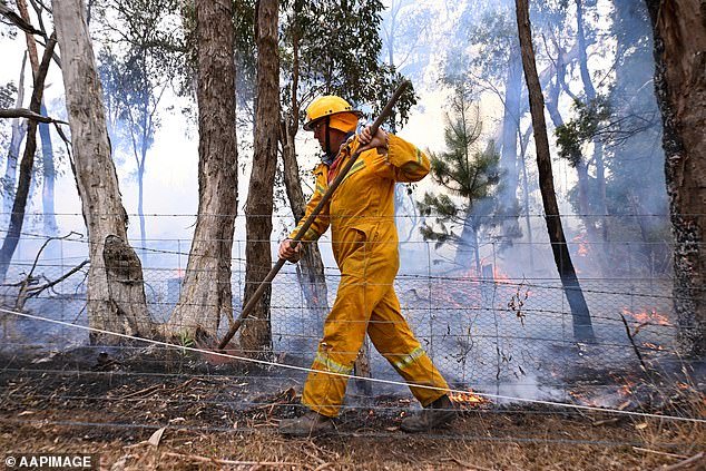

Areas with an extreme fire danger rating on Wednesday in Victoria were the Mallee, Northern Country, North Central, Central and South West regions (pictured, a firefighter in Raglan, Victoria).
It comes as a A broad low pressure system and associated monsoon trough is forecast to produce showers and thunderstorms across much of northern Australia, including parts of queenslandthe Northern Territory and Western Australia.
The wet and stormy weather is expected to spread further south and west as the week progresses.
weather zone Meteorologist Ben Domensino said the week’s rain over northern and central Australia will fall on areas that still contain groundwater from Tropical Cyclone Lincoln.
“This will increase the risk of flash flooding and inland road closures in the event of periods of heavy rain over the next week,” Mr Domensino said.
In other capitals such as Brisbane, residents are in for a warm and sunny week with temperatures set to remain in the 30s.
Perth residents will see a hot and dry week with the mercury forecast to reach 33C on Thursday and 34C on Friday.
Some rain is possible in Hobart on Wednesday with a high of 31C, and the rest of the week will be between 20C and 20C.
Canberra will be dry and hot, with a sweltering 34C expected on Thursday.
Darwin is still in its wet season with storms forecast this week and a high of 32C.
