Table of Contents
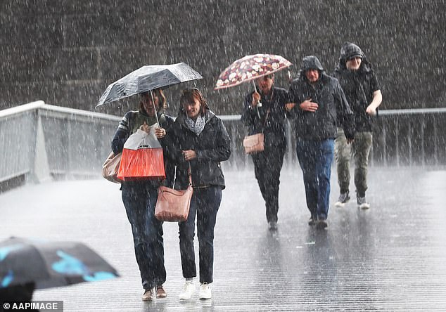
Residents in Queensland and New South Wales are being warned to prepare for a freak weather system that could dump up to 150mm of rain along the east coast, with fears of flash flooding in several regions.
Widespread rain and thunderstorms are expected to hit parts of Australia’s east coast this week.
The Bureau of Meteorology is warning that widespread and isolated thunderstorms could occur across parts of central and eastern Queensland from Monday as an upper trough system interacts with deep moisture from the Coral Sea.
While the trough is likely to move south along the east coast from Monday and move inshore on Wednesday, another trough is forecast to develop between Mackay and Hervey Bay on Monday or Tuesday.
Widespread rainfall of 25-50mm is forecast from Cairns to south-east Queensland.
But meteorologist Dean Narramore said the trough could become stagnant on Monday or Tuesday, leading to heavier rain concentrated in central Queensland.
“They could reach between 100 and 150 mm, and possibly even more,” he said on Sunday.
“Fortunately… we do not expect a major flooding scenario at this time.”
Australians in Queensland and New South Wales are being warned to prepare for wet weather as a tropical depression is forecast to bring up to 150mm of rain.
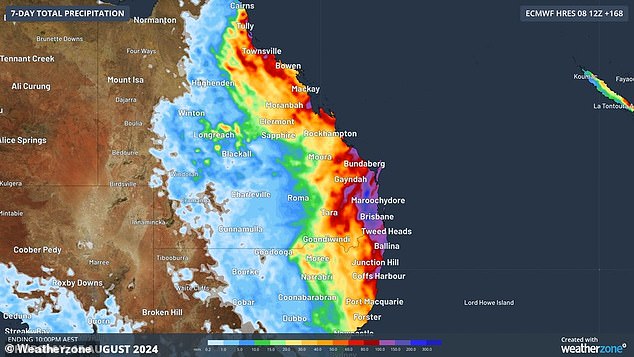
Parts of the Queensland coast could receive up to 150mm of rain due to the upcoming storm (pictured)
A flood watch warning is now in effect for coastal catchments in south-east Queensland, with minor flooding possible in those areas from Monday.
“There is significant uncertainty in the timing and location of rainfall, although the coast and adjacent areas are most likely to experience the heaviest rainfall,” the warning reads.
‘Localised rises in river levels and flash flooding are likely in areas of higher rainfall, with the possibility of minor isolated riverine flooding.’
Locals are being sought because flooding could disrupt transportation and cause isolation in some communities.
Catchments likely to be affected include the Mary River, Noosa River, Sunshine Coast rivers and creeks, Pine and Caboolture Rivers, Upper Brisbane River, Lower Brisbane River, Logan and Albert Rivers and Gold Coast rivers and creeks.
Heavy rain is also expected to hit rivers in northern New South Wales from Monday into next week, with river levels likely to rise.
Minor flooding is possible on the Tweed and Rous Rivers, the Wilsons River and the Richmond River.
River levels are also slowly rising along the River Lachlan at Booligal Weir, with a prolonged minor flood peak likely over the next few days.
The river is currently at 2.53 metres and is slowly rising and could peak at 2.60 metres in the coming days.
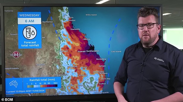
BoM meteorologist Dean Narramore (pictured) said the trough could stagnate on Monday or Tuesday, leading to heavier rainfall concentrated in central Queensland.
Marine wind warnings will also be issued for coastal areas of Western Australia, South Australia, New South Wales and Tasmania on Monday.
While showers are likely to hit Melbourne on Wednesday, the mercury is forecast to hit 20C from Monday into Thursday.
Temperatures in Sydney are likely to remain around 20 degrees for much of the week, while temperatures in Brisbane will rise to around 20 degrees from Friday.
Perth and Adelaide will experience rain for much of the week while enjoying temperatures in the mid-20s.
Temperatures in Hobart are expected to peak at 20°C on Tuesday.
Sydney
Monday: Partly cloudy. High chance of rain. Light winds. Maximum 20 °C.
Tuesday: Cloudy. High chance of showers, more likely in the morning. Light winds. Min. 13 °C Max. 20 °C.
Wednesday: Cloudy. Medium chance of showers, more likely in the morning and afternoon. Light winds. Min. 13 °C Max. 20 °C.
Melbourne
Monday: Sunny. Northerly winds at 20 to 30 km/h. Maximum of 20 °C.
Tuesday: Mostly sunny. North winds at 20 to 30 km/h. Minimum 11 °C Maximum 20 °C.
Wednesday: Cloudy. Medium chance of rain, more likely in the afternoon and evening. Northerly winds at 20 to 30 km/h. Minimum 13 °C Maximum 20 °C.
Brisbane
Monday: Cloudy. High chance of showers, decreasing in the evening. Chance of thunderstorms. Winds from the southeast at 15 to 20 km/h, tending to the east at 15 to 25 km/h at midday and increasing to 25 to 35 km/h in the late afternoon. High of 19 °C.
Tuesday: Cloudy. High chance of rain, more likely from dawn onwards. Winds from the east at 25 to 40 km/h. Min. 17 °C Max. 22 °C.
Wednesday: Cloudy. High chance of rain. Winds from the east at 20 to 30 km/h, easing in the afternoon. Min. 16 °C, max. 22 °C.
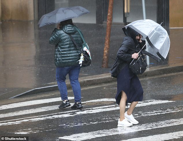
Local residents are being sought, as flooding could disrupt transportation and cause isolation in some communities.
Canberra
Monday: Partly cloudy. Chance of light rain in the afternoon and evening. Light winds. Max 18 °C.
Tuesday: Partly cloudy. Chance of light rain. Chance of morning fog. Light winds. Min. 4 °C Max. 17 °C.
Wednesday: Cloudy. High chance of showers, more likely in the morning and afternoon. Light winds. Min. 5 °C Max. 16 °C.
Hobart
Monday:Mostly sunny. Winds from the north to northwest at 15 to 20 km/h, becoming light in the late afternoon and then north to northwest at 15 to 20 km/h in the evening. Max. 18 °C.
Tuesday: Mostly sunny tomorrow. Chance of light rain, more likely at night. North winds at 20 to 30 km/h. Minimum 10 °C Maximum 20 °C.
Wednesday: Partly cloudy. Medium chance of rain. Winds from the north to the northwest at 15 to 20 km/h, becoming west to northwest during the morning and then light during the afternoon. Min. 11 °C Max. 18 °C.
Perth
Monday: Partly cloudy. High chance of showers, decreasing tonight. West winds at 20 to 30 km/h, increasing to 30 to 40 km/h near the coast, before decreasing to 15 to 20 km/h overnight and then becoming light late tonight. High 21°C.
Tuesday: Partly cloudy. High chance of showers. Light northwest winds at 20 to 30 km/h in the morning. Min. 12 °C Max. 20 °C.
Wednesday: Cloudy. Very high chance of showers, most likely in the morning and afternoon. Chance of thunderstorms in the southwest. Winds from the west to the northwest at 15 to 25 km/h tending to the west to the southwest at 25 to 40 km/h during the day. Min. 13 °C Max. 20 °C.
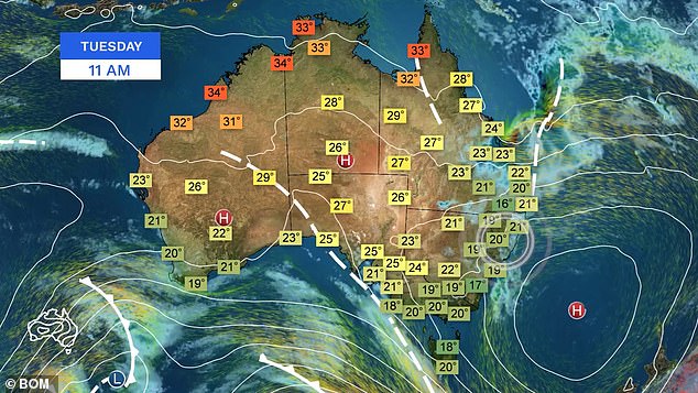
Another trough is forecast to form between Mackay and Hervey Bay on Monday or Tuesday.
Adelaide
Monday: Mostly sunny. Winds from the north at 20 to 30 km/h, becoming light in the late afternoon and northeasterly at 15 to 20 km/h in the late evening. High of 23 °C.
Tuesday: Cloudy. Medium chance of showers, most likely in the afternoon and evening. Winds from the north to northeast at 15 to 25 km/h, becoming north to northwest in the morning and then light in the afternoon. Min. 13 °C Max. 21 °C.
Wednesday: Mostly sunny. Chance of light showers. Light north to northwest winds at 15 to 20 km/h during the morning then light during the day. Min. 12 °C Max. 20 °C.
Darwin
Monday: Sunny. Southeast winds at 15 to 25 km/h, becoming light in the early afternoon. High of 33 °C.
Tuesday: Sunny. Light east to southeast winds at 15 to 20 km/h in the morning and then light in the afternoon. Min. 20 °C Max. 33 °C.
Wednesday: Sunny. Light north to northwest winds at 15 to 20 km/h during the afternoon then light at night. Min. 20 °C Max. 32 °C.


