Although much of the country remains unusually free of major winter stormsA strong blocking pattern has kept Atlantic Canada under the spell of a stubborn setup this week.
DON’T MISS: Canada remains abnormally free of major storms this week
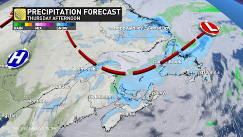
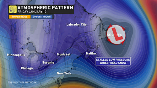
As long as the blocking pattern holds over the North Atlantic, the powerful storm that reached the region last weekend will continue to meander through the end of the week. It will slowly weaken, but will still bring blustery conditions, along with rain and snow at times.
Until Friday:
Scattered snow showers have moved across the region in recent days, as several troughs associated with the retrograde low return to the area. This pattern will continue until the end of the week.
SEE ALSO: January is the snowiest month in Canada. This is what you can expect
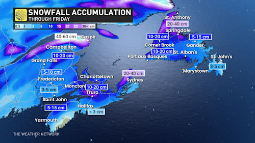
Northern Newfoundland and Labrador will continue to see the highest snowfall accumulations, with low pressure over the area. Between 10 and 20 cm of snow is forecast when all is said and done, with up to 40cm possible in some of the most affected areas.

Along Newfoundland’s Atlantic coast, there could be some mixing with light rain or even light, freezing drizzle at times.
RELATED: Parts of eastern Canada see prolonged snow due to reverse storm track
Strong northwesterly winds blowing across the St. Lawrence Seaway will continue to generate flurries of snow in eastern New Brunswick, PEI, and western Newfoundland.

Drivers are urged to plan ahead and adapt to changing and deteriorating conditions. Major routes such as Highway 2 through Moncton and the 104 into Nova Scotia will be snow-covered and slippery at times.
Highway 430 along the Long Range Mountains in Newfoundland and Highway 1 from Gander and west will also be snow-covered and slippery.
Above-seasonal temperatures will dominate until mid-January, but colder weather will extend to the Maritimes for a few days later in the week. The storm’s track is mostly expected to be well south of the region next week, but could then move northward, possibly causing impacts in the region during the second half of January.


