Anxious residents in two regional areas are waiting for floodwaters to recede after emergency alerts were issued over rising river levels following days of heavy rain.
People in Queensland’s Western Downs and South Burnett have been told to be prepared to evacuate their homes ahead of possible flooding.
“Residents in low-lying areas should PREPARE NOW,” Queensland Police said in an alert early on Thursday.
“Notify neighbors, secure your belongings and put your emergency plan in place.”
It comes after days of heavy rain in southeast Queensland that caused flooding and power outages.
Conditions are forecast to improve, but the northern part of the state could be in the firing line of torrential downpours with a possible storm system forming off the coast.
Western Downs Mayor Andrew Smith said the council was monitoring the situation in Jandowae after the local dam began spilling overnight.
‘Water is still entering the dam. It’s more like looking and seeing,” he told ABC Radio.
Parts of northern Queensland are expected to be hit by severe thunderstorms bringing a deluge of rain, while rainfall is expected to ease in southern areas of the state (pictured).
“We’ll wait and see what happens during the day, but I think the forecast is very favorable.”
A major flood warning has also been issued for downstream of the River Logan at Beaudesert, which is expected to reach 8.3 meters on Thursday.
However, weather conditions are forecast to improve in the southeast on Thursday, as a southeasterly surge from New South Wales moves northwards.
“That means the rain will start to dissipate in areas of the south-east and continue in parts further north,” said Miriam Bradbury of the Bureau of Meteorology.
As residents in the southeast wait for flood waters to recede, northern Queensland is bracing for the next deluge of wet weather.

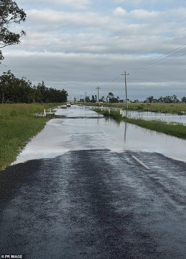
It follows a week of rain across the Sunshine State causing flash flooding that covered roads (pictured, flooding on the Western Downs)

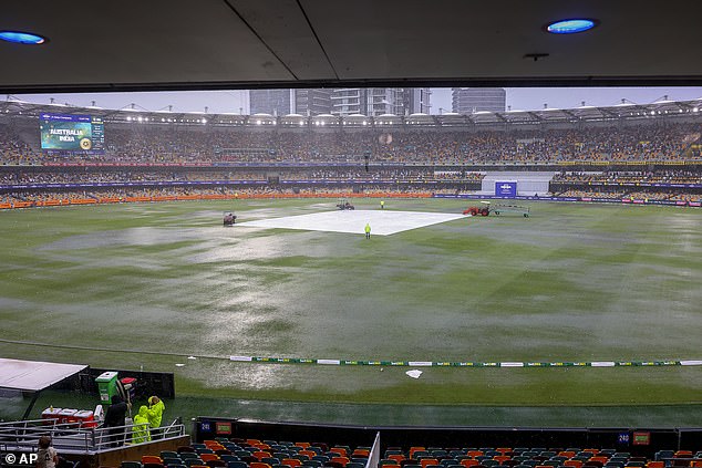
Heavy rain in Brisbane caused days one and three of the third Test between Australia and India to be delayed and puddles covered most of the Gabba (pictured).
The office warned that a depression off the Townsville coast will move northwards from Thursday and remain for days.
A weak depression embedded in the trough is possible later in the week, but the bureau believes it is unlikely to become a tropical cyclone.
Daily rainfall totals of up to 60mm are forecast on Thursday and up to 80mm on Friday, but there could be heavier localized falls of up to 200mm.
“There is significant uncertainty as to the timing and location of the heaviest rainfall, although small coastal basins may receive the highest rainfall totals,” the office said.
“Localized river level rises and flash flooding are likely in areas of higher rainfall, and minor, isolated river flooding is possible.”
Sydney
Friday: Mostly sunny. Min. 12°C Max. 26°C
Saturday: Possible shower. Min. 14°C Max. 19°C
Sunday: Rains increasing. Min. 11°C Max. 21°C
brisbane
Friday Partly cloudy. Minimum 19°C Maximum 29°C
Saturday Mostly sunny. Min. 19°C Max. 31°C
Sunny Sunday. Min. 20°C Max. 31°C
Melbourne
Sunny Friday. Minimum 17°C Maximum 33°C
Cloudy Saturday. Minimum 16°C Maximum 21°C
Sunday shower or two. Minimum 14°C Maximum 23°C
Adelaide
Sunny Friday. Min. 18°C Max. 31°C
Saturday Mostly sunny. Minimum 15°C Maximum 29°C
Sunday Partly cloudy. Minimum 13°C Maximum 25°C

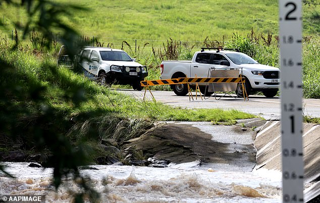
Flooding also affected areas of the south-east, cutting off access to roads north of the Gold Coast (pictured)
Perth
Sunny Friday. Min. 16°C Max. 34°C
Sunny Saturday. Min. 21°C Max. 37°C
Sunny Sunday. Min. 21°C Max. 40°C
Canberra
Friday Early fog then sunny. Min. 9°C Max. 32°C
Sunny Saturday. Minimum 13°C Maximum 34°C
Sunday Partly cloudy. Min. 13°C Max. 32°C
Darwin
Friday Shower or two. Possible storm. Min. 27°C Max. 34°C
Saturday Shower or two. Possible storm. Minimum 27°C Maximum 35°C
Sunday rains. Possible storm. Min. 27°C Max. 34°C
hobart
Friday Mostly sunny. Min. 12°C Max. 26°C
Saturday Possible shower. Min. 14°C Max. 19°C
Sunday rains increasing. Min. 11°C Max. 21°C


