A blistering winter heatwave combined with wind gusts of up to 100km/h have sparked a series of bushfires across New South Wales, as fire chiefs issue an urgent warning to rural property owners.
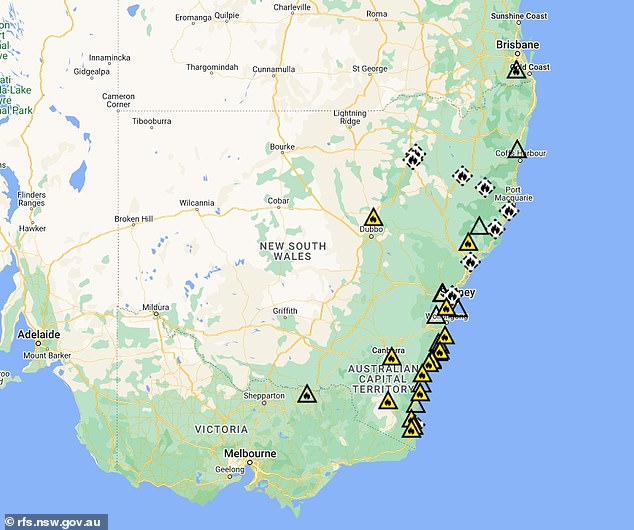
More than a dozen bush and grassland fires have broken out along the New South Wales south coast on Wednesday, with the Illawarra and Shoalhaven regions in the state’s southeast particularly hard hit.
Unusually high temperatures combined with strong winds of more than 100km/h have fuelled the fires, prompting the NSW Rural Fire Service (RFS) to urge landowners to pause any planned burning.
“Bush and grassland fires can occur at any time of year, but today we are seeing very strong and gusty winds, particularly in the Sydney metropolitan area and the Illawarra and Shoalhaven areas,” an RFS spokesperson told Daily Mail Australia.
‘That’s why you see a little strip of fires on the coast there; Shoalhaven in particular has been quite busy since last night.
‘Trees and power lines have fallen and we’ve had a few instances of hazard reduction burns by private landowners being reignited by the wind.’
The spokesman urged landowners to refrain from “private burning to reduce risks.”
‘This is the time of year when we traditionally see a lot of landowners out and about, which is fantastic.
More than a dozen bushfires and grassland fires have broken out along the New South Wales south coast on Wednesday, with the Illawarra and Shoalhaven in the state’s south-east particularly hard hit (pictured)

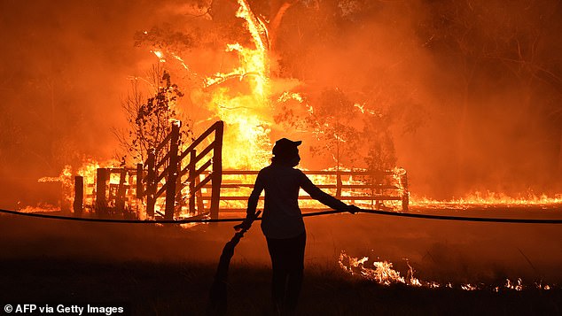
Unusually high temperatures combined with strong winds of more than 100km/h have fuelled the fires, prompting the NSW Rural Fire Service (RFS) to urge property owners to pause any planned burning (pictured: Residents defend a property from a bushfire in Hillsville near Taree, 350km north of Sydney on 12 November 2019)
“But on days like today, we urge you to hold off, to not light any fires because the last thing we want is for those fires to get out of hand and out of control and potentially threaten your home or your neighbor’s property as well.”
All fires are currently under control and there are no emergency warnings in place, according to the RFS website.
This comes as urgent weather warnings have been issued for five Australian states, with forecasters predicting large areas of the country will be hit by damaging winds.
Western Australia, New South Wales, Victoria, South Australia and Tasmania are in the firing line for dangerous conditions on Wednesday, with rain also on the horizon.
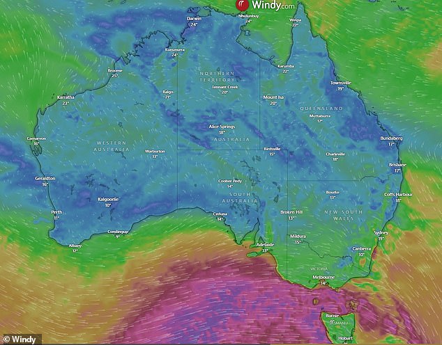
The Bureau of Meteorology has issued severe weather warnings for damaging winds for south-east Australia, with wind gusts of up to 130km/h possible.
The gusts of wind are the result of one of the coldest fronts of the year moving towards the southeast.

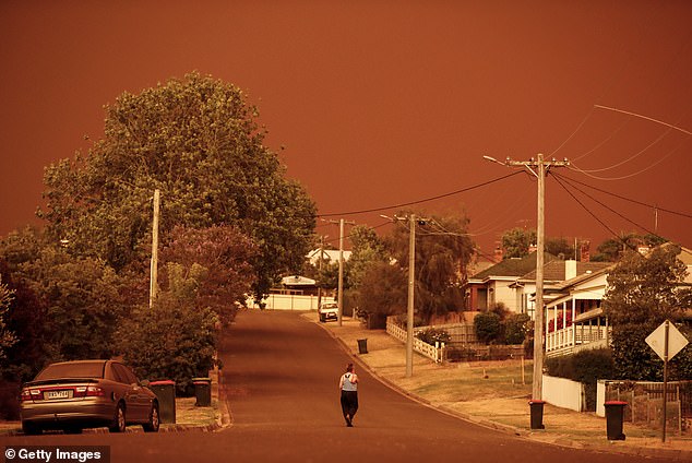
The RFS spokesperson urged landowners to refrain from carrying out “private risk reduction burns” (pictured: A woman looks down her street as the sky turns red from the bushfires on 4 January 2020 at Bruthen in East Gippsland, Victoria)
Conditions are expected to be so bad that Victoria SES boss Tim Wiebusch issued an urgent warning to residents on Tuesday.
“Victorians need to act and prepare now for what could be the strongest weather system we have seen this winter in our state,” he said.
‘Please be sure to drive according to the conditions, and be alert on our roads for the risk of falling trees and debris that may be present over the next 36 hours.’
In New South Wales, a severe weather warning for damaging winds has been issued for Sydney, Illawarra and parts of the metropolitan, south coast, central tablelands, southern tablelands, snowy mountains and hunter forecast districts.
Damaging winds averaging 60 to 70 km/h are likely, with peak gusts of around 100 km/h in parts of the Blue Mountains and western Sydney.
Winds averaging 70 to 80 km/h with peak gusts of around 110 km/h are expected in the Illawarra region, easing in the early afternoon.
Similar warnings have been issued in Victoria for the forecast districts of Central, East Gippsland, South West, West and South Gippsland, and parts of North Central, North East, Wimmera and Northern Country.
BOM meteorologist Sarah Scully said the cold front would bring “really windy conditions and gusty rain and thunderstorms” to parts of south-east Australia.
“In New South Wales it will be generally dry, but it will be a very windy day and there will be showers in southern areas,” he said.

Urgent weather warnings have been issued for five Australian states as much of the country is set to be battered by damaging winds.

The windy conditions come amid unusually warm temperatures for parts of the country, with Brisbane forecast to be 8C warmer than average on Wednesday and reach a high of 31C.
There will be a lot of wind, especially in Sydney and the Illawarra region.
‘For Victoria, it will also be a very windy day, while for South Australia there will be a breezy start on Wednesday, but winds will ease by early afternoon.’
These windy conditions come amid unusually warm temperatures for parts of the country, with Brisbane forecast to be 8°C warmer than average on Wednesday and reach a high of 31°C.
On Monday, a Scorching 41.6°C was recorded in the Yampi Strait in the northwest Western Australia: Highest winter temperature ever recorded in Australia.
The Bureau predicts rising temperatures will continue throughout the week, with some areas seeing highs around 11°C higher than average for the end of winter.


