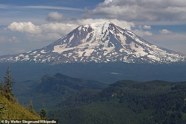
Scientists have been baffled by a record increase in earthquakes near Washington’s Mount Adams, which has been dormant for thousands of years.
The volcano is considered a “high threat” due to its ability to cause landslides, debris avalanches and mud flows that can travel up to 50 miles per hour downhill, which would put thousands of people at risk.
The region typically experiences earthquakes once every three years, but the United States Geological Survey (USGS) detected six in September, with a magnitude between 0.9 and 2.0.
Although very weak, previous studies have suggested that swarms of small earthquakes can precede a volcanic eruption.
Scientists have recorded a significant increase in earthquakes around Washington State’s most active volcano: Mount Adams Volcano.
Earthquakes near Mount Adams normally occur only once every two or three years, and thIt is the largest number of earthquakes in a single month since scientists began recording earthquakes in this area in 1982.
The six earthquakes were recorded at a seismic station seven miles southwest of the summit of Mount Adams, located in the southwestern Gifford Pinchot National Forest, and at other stations much further away from the volcano.
Scientists at the Cascades Volcano Observatory (CVO) and the Pacific Northwest Seismic Network (PNSN) plan to install a set of temporary seismic stations around Mount Adams to investigate the size, location and depth of the earthquakes, according to the USGS .
“This will improve our ability to locate smaller earthquakes with greater certainty and help understand the cause of these earthquakes. The results of our findings will determine whether additional actions are needed,” USGS officials wrote in a statement.
In some cases, earthquakes near volcanoes can cause eruptions.
But this only happens if the earthquake is large (greater than magnitude 6) and the volcano is already about to erupt.
When those conditions are met, the earthquake could cause dissolved gases to come out of the magma similar to a shaken soda bottle, increasing the pressure inside the volcano and potentially causing an eruption.
But these six earthquakes were too small to cause an eruption.
And the USGS said there is no threat of an imminent eruption.
Therefore, this increase in seismic activity is not a sign that Mount Adams is about to explode, USGS officials said.
Mount Adams was formed approximately 520,000 years ago. It is located approximately 70 miles northeast of Vancouver, Washington and Portland, Oregon.

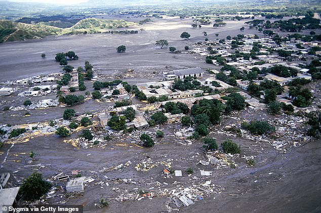
The biggest threat to people living near this volcano are lahars, or muddy flows of rock, ash and ice, like the one that destroyed this city in Colombia after a volcanic eruption in 1985.
Although Mount Adams is considered a “high threat” volcano, it has not erupted in thousands of years.
Scientists estimated that its most recent eruption occurred between 3,800 and 7,600 years ago.
And throughout its history, Mount Adams has primarily produced effusive eruptions, which differ from explosive eruptions in that they do not send lava, gas and ash into the sky, but instead form slow-moving lava flows that creep along the slopes of the volcano.
But the biggest threat to people living near this volcano is not an eruption.
These are actually avalanches, landslides and lahars, or muddy flows of rock, ash and ice that “emerge downstream as rapidly flowing concrete” and can occur during eruptive or non-eruptive periods, according to the USGS.
“The ice-covered summit conceals large volumes of hydrothermally weakened rock, and future landslides of this weakened rock could generate long-haul lahars,” USGS officials wrote.
The new temporary monitoring stations will allow scientists to collect more data on seismic activity beneath Mount Adams, helping them detect smaller earthquakes and better understand what caused the recent increase in activity.
“The results of our findings will determine whether additional actions are needed,” USGS officials said.

