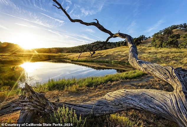
America’s most inaccessible state park remains nearly impossible to visit more than 20 years after California bought it, because it remains surrounded by private land that no one is willing to sell.
The state spent $3 million on 1,800 acres north of Sutter Buttes in 2003 with the goal of protecting one of the country’s most spectacular and historic landscapes.
The extinct volcanic lava field was sacred to Native Americans and played a key role in the 19th century plot to seize California from Mexico.
But every road leading to the park is privately owned, some of them owned by families who have been on the land for nearly 200 years.
“The state will buy everything we are willing to sell,” landowner Marty Steidlmayer told the Los Angeles Times. “But that’s the last thing my family would do.”
California State Parks says the area in the middle of the Sacramento Valley is packed with “natural, cultural, geological, scenic and recreational resource values.”

Sutter County Board Supervisor Mat Conant, right, said the land rights of families who have owned neighboring land for 200 years are more important than public access.
Photographs of the park in the Sacramento Valley adorn the California State Parks website, immediately below a long-standing notice that reads: “The park is currently CLOSED.”

The area was first designated as a public park in the 1920s, when National Park Service founder Frederick Law Olmsted Jr added it to a list of potential sites.
The only public access is offered by a trust that offers heavily escorted walking tours for $35 a head on land adjacent to the state park.
“I don’t understand why it’s not open,” said Francis Coats, who faced death threats when he tried to visit the 160 acres his family has owned for decades on the north side of South Butte.
The area was first designated as a public park in the 1920s, when National Park Service founder Frederick Law Olmsted Jr added it to a list of potential sites.
The volcanic spiers rise 2,000 feet high in a 10-mile site dubbed “the smallest mountain range in the world.”
Lakes and green pastures lie at the heart of a stretch known as the “Valley of Peace,” dotted with dry stone walls.
It was sacred to the Maidu people for thousands of years and was used as a hideout by Kit Carson and General John C. Fremont as California riots raged against Mexican rule in the 1840s.
The owners began offering limited private tours as pressure for public access grew in the 1970s and a manager was hired who lived happily in a cabin on the site with his wife, dog and cat until a eagle snatched the cat.

Historian Walt Anderson said that once people see the Buttes in person “they are hooked.”

The landscape was formed by volcanic eruptions between 1.35 and 1.6 million years ago.
“Some places attract us more powerfully than others,” said historian Walt Anderson. “I mean, everyone loves the profile of the hills when they go over them, but once they get in, I mean, they’re hooked.”
The county Board of Supervisors managed to keep the area completely private until 2003, when 1,785 acres came on the market and were acquired by the state.
The Parks Department had a successful history of creating state parks from individual land purchases made over years or even decades.
The State Parks and Recreation Commission declared its 1,785 acres a park in 2005, but nearly 20 years later it remains as inaccessible as before.

The county Board of Supervisors managed to keep the area completely private until 2003, when 1,785 acres came on the market and were acquired by the state.
Steidlmayer claimed the department would “let people in, free and unattended,” if they could cause irreparable damage to the landscape.
“This small mass in the middle of the Sacramento Valley is very sensitive to invasion,” he added.
The Sutter County Board led the charge to keep the land private in the 1970s when Supervisor JA Bagley promised, “We will fight them, to the end.”
And his successor, Mat Conant, told the LA Times that the fight continues today.
“It’s more important to protect those land rights,” he said.

But only sheep and cattle have regular access to the spectacular landscape.

The site served as a hideout for Kit Carson and General John C. Fremont as California unrest under Mexican rule raged in the 1840s.
“Some families have kept those lands for close to 200 years.”
The department said it “continues to seek opportunities to secure land or easements to provide access.”
But former department head Ruth Coleman said he may have to be more imaginative if the public ever wants to see the park they spent money on.
It is classified as a state park. And a state park has access,” he said. “I’ve been there, it’s magical.”


