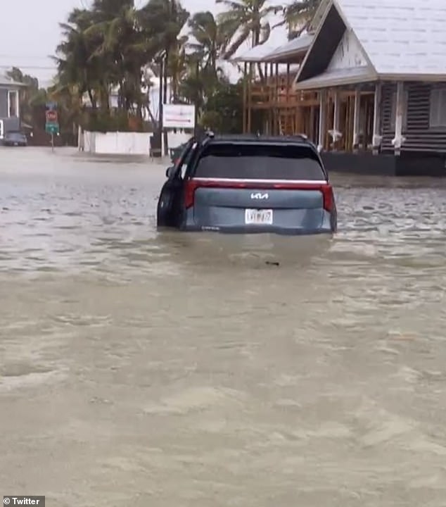
A tropical storm preparing to make landfall as a hurricane has already caused flooding along Florida’s Gulf Coast.
Tropical Storm Debby brought a storm surge of at least two feet to southwestern cities like Fort Myers, with photographs showing cars there completely underwater.
The storm is currently on a collision course with Tampa, National Hurricane Center officials said, indicating it will strengthen into a Category 1 storm by Sunday night.
The city’s airports have been thrown into chaos, with at least 120 flights cancelled, including departures and arrivals, at Tampa International Airport.
Of the 496 flights on the day, nearly 200 are experiencing delays, while the situation at nearby Sarasota-Bradenton International Airport is not much better. Rain bands from the storm are now moving across the area, affecting countless coastal cities.
Scroll down to watch the video:
Tropical Storm Debby brought a storm surge of at least two feet to southwestern cities like Fort Myers, with photos showing cars there completely underwater.
“Debby will produce a variety of significant and life-threatening impacts over the next several days,” AccuWeather Chief Meteorologist Jon Porter warned over the weekend after flooding was reported in parts of South Florida on Saturday night.
‘We urge individuals, businesses and government officials in the path of the storm to check AccuWeather forecasts frequently, even more than they normally would.
“This storm is going to be a long and dangerous week for people in parts of the southeastern United States,” the expert also warned.
‘Please do not be lulled into a false sense of security that Debby is currently classified as a tropical storm.
‘Tragically, we have seen many situations in the past where people have not prepared to the level necessary to deal with the dangerous threats that exist in a storm of this type due to the limitations of the Saffir-Simpson Hurricane Wind Scale.’
The expert went on to point out how the metric used by most meteorologists and the National Hurricane Center “only categorizes a tropical storm or hurricane by its wind intensity,” and not by its propensity to generate storm surge.
He said one storm that fooled the wind scale was the 2018 hurricane that hit the Carolinas, known as Florence, which made landfall as a Category 1 hurricane on the scale but would have been a 4 on AccuWeather RealImpact because of the catastrophic flooding it caused.
Debby has the potential to create life-threatening storm surges of six to 10 feet, Porter and other experts said.
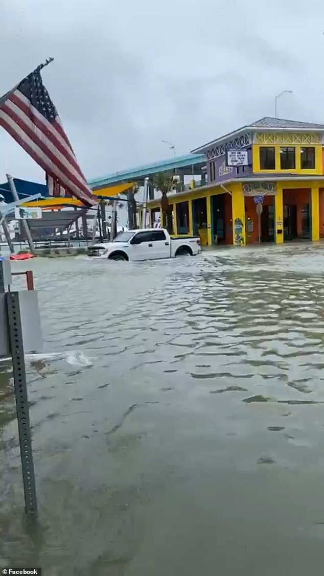
Here you see more of Fort Myers, located right in the middle of Florida’s Gulf Coast.
A preview of what’s to come was seen in coastal cities like Fort Myers, Sanibel Island and Gulf Port, all located along the state’s famously volatile West Coast.
Meanwhile, the storm continues to move slowly through the Gulf of Mexico, where it is gaining strength.
It is expected to hit the Sunshine State around 8 p.m., officials said, when its full wrath will be felt.
By Monday morning, rainfall totals of around six to 12 inches are expected, with maximum amounts of 18 inches in some areas further north.
Meanwhile, as Porter mentioned, the situation is constantly evolving, masking “the magnitude of the storm’s dangers and impacts throughout the week,” the meteorologist warned.
Widespread flooding is also possible in the Southeast, he said, as the storm will move northeastward across the state around 6 a.m. Monday, before heading out to the Atlantic around 8 p.m.
During that period, cities like Gainesville and Jacksonville will be at risk, along with areas along the East Coast like Fernandina Beach and St. Augustine.
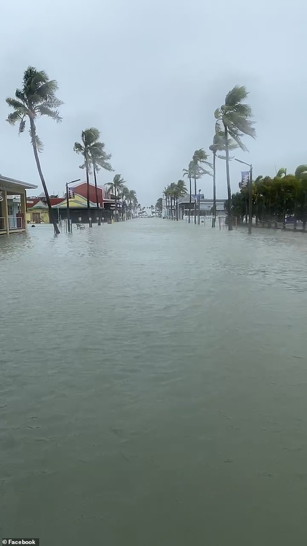
More flooding on Sunday in Fort Myers as bands of rain from the storm move through the area and affect countless coastal towns.
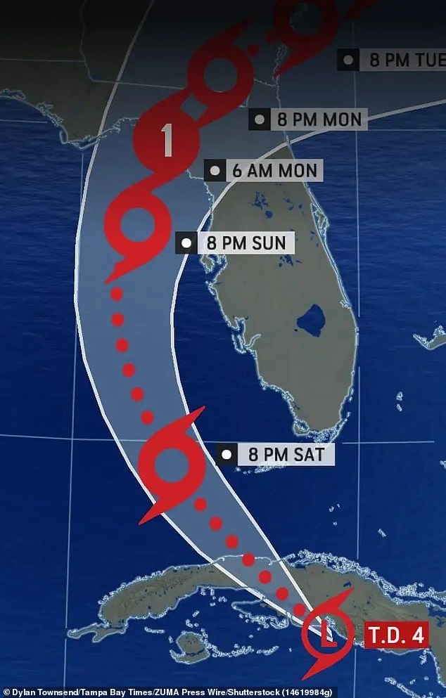
Officials also said widespread flooding is possible across the Southeast as the storm moves northeastward across the state around 6 a.m. Monday, before heading out to the Atlantic around 8 p.m.
Fort Myers appears to be the hardest hit so far, although despite the intense flooding no official evacuation order has been given.
Cape Coral is also experiencing flooding, as is sister city barrier island Sanibel and Gulf Port further north.
The latter is expected to be bombed when the storm hits Tampa around 8 p.m. as it moves north.
At that time, forecasters predict it will turn northeast, passing over southern Georgia and the northern part of the state.
By then, Debby is forecast to be a full-blown hurricane and could strengthen further.
Citizens in affected areas are advised to stay indoors. Power outages are expected.
“As AccuWeather hurricane experts have been emphasizing since last week, ahead of other known sources, confidence is increasing for widespread flooding due to persistent heavy rainfall across portions of the southeastern United States,” officials said Saturday.
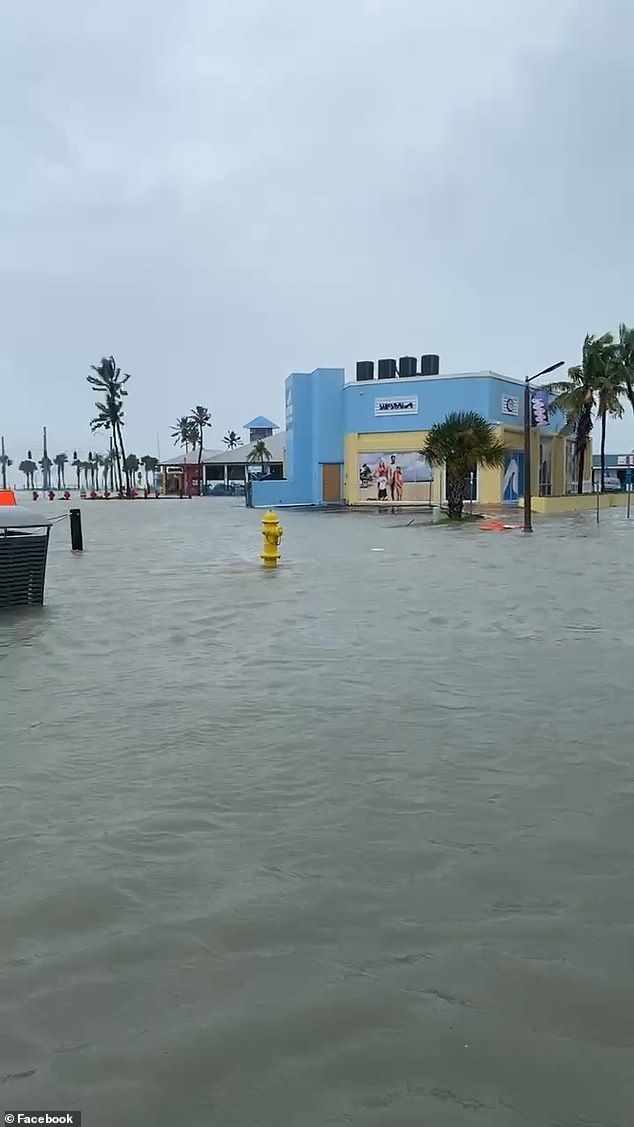
“Experts are increasingly concerned that if heavy rain bands produce heavy rainfall in the same areas for days at a time, it could lead to catastrophic flooding in some locations,” officials said. Here’s a look at the flooding in Fort Myers, which reached at least two feet on Saturday.
“Experts are increasingly concerned that if heavy rain bands produce heavy rainfall in the same areas for days, a catastrophic flooding disaster could occur in some places,” Porter personally reiterated.
‘If there is heavy rain in the interior of the Carolinas, that water will eventually enter rivers and other waterways that flow toward the coast.
‘Water flowing toward the coast, coupled with persistent landward flow, can cause rivers to become stagnant because they will not be able to drain, further amplifying what can already be major flooding concerns along and near coastal areas.’


