Climate change could trigger a new wave of ‘megahurricanes’ so powerful that scientists say a new category is needed to measure them.
Since the 1970s, the National Hurricane Center has used the Saffir-Simpson wind scale to measure hurricanes on a scale of one to five.
But now, scientists at Lawrence Berkeley National Laboratory say the scale should be expanded to include category six hurricanes.
With sustained winds of over 192 mph (309 km/h), hurricanes in this new category have wind speeds as fast as a Lamborghini Gallardo.
Over the past decade, only five storms would have fallen into this new category, but researchers say the risk will increase as the climate warms.
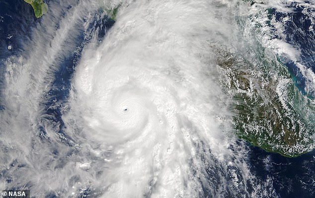
Researchers say storms are becoming so powerful due to climate change that massive hurricanes like Hurricane Patricia, photographed here over the Atlantic Ocean in 2015, should have a new category created for them.

Researchers propose a new hypothetical category six to measure hurricanes. These storms have sustained winds of more than 309 km/h (192 mph), as fast as a Lamborghini Gallardo.
Hurricanes, also called tropical storms or typhoons, are currently classified according to their sustained wind speeds.
Category one hurricanes have wind speeds of 74 mph (119 km/h).
In category three, which is considered a risk of serious damage to life and property, there are sustained wind speeds between 111 and 129 mph (178-208 km/h).
Meanwhile, category five, reserved for the most devastating storms, starts at 252 km/h (157 mph) but is open-ended.
The reason the scale stops here is that it is intended to reflect property damage and it was believed that a category five hurricane would completely destroy any structure in its path.
However, IIn his article, published in proceedings of the National Academy of SciencesDr. Wehner and his co-author suggest that the scale should be expanded to include a hypothetical category six.
He says: “Our motivation is to reconsider how the open-ended nature of the Saffir-Simpson scale can lead to an underestimation of risk and, in particular, how this underestimation becomes increasingly problematic in a warming world.”
Following the pattern of gaps between the previous categories, researchers set lower limits for category six and examined past weather data to see if any hurricanes would qualify.
In an analysis of data from 1980 to 2021, they found that five storms would have been classified as category six and that all occurred in the last nine years of records.
Those five storms include some of the most powerful and destructive hurricanes in recent history.
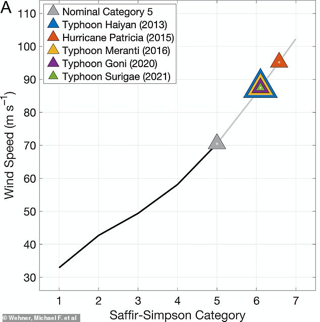
This graph shows how the Saffir Simpson category relates to wind speed. The colored triangles show storms that researchers would classify as category six. As you can see, they are well beyond the category five boundary (shown as a gray triangle).
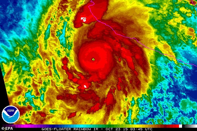
This diagram shows Hurricane Patricia as it approaches the coast of Mexico. At the center of the storm, shown in dark red, the wind speed was 198 mph (320 km/h), which would make it a category six hurricane.
Hurricane Patricia, for example, had winds of 201 mph before making landfall in the Gulf of Mexico.
Meanwhile, Typhoon Haiyan killed thousands of people when it hit the Philippines in 2013.
The authors note that even at that time Typhoon Haiyan was so powerful that many called for it to be classified as category six.
According to study co-author Dr. James Kossin of the First Street Foundation, the Saffir-Simpson wind scale is far from perfect as a means of communicating hurricane risk.
This is because much of the damage and deaths caused by hurricanes is not due to wind speed but rather due to storm surge, flooding, and heavy rain.
Dr Kossin says: “Messaging changes are needed to better inform the public about inland flooding and storm surge, phenomena for which a wind-based scale is only tangentially relevant.”
“Our results are not intended to propose changes at this scale, but rather to raise awareness that the wind risk from storms currently designated as Category 5 has increased and will continue to increase due to climate change.”
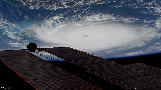
Category five storms like Hurricane Dorian, seen here from the International Space Station, are already extremely dangerous. But researchers warn that even more powerful storms are likely to become more common in the future as the planet warms.
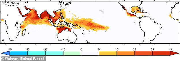
This diagram shows how many days wind speed exceeded ‘category six’ levels between 1979 and 2019. Darker red regions had more days of category six wind, such as the northwest coast of Australia, which had up to 45 days in some areas
And, as the climate continues to warm, storms that would fall into category six are likely to become more frequent.
Typhoons, hurricanes and tropical storms, which are essentially the same weather phenomena, occur when warm, moist air rises from the ocean.
As human-induced climate change increases the Earth’s temperature, seas and oceans are warming in regions where these storms normally form.
This means there is more thermal energy to drive the storm, leading to more powerful and dangerous storms.
According to the researchers’ simulations, a temperature increase of just 2°C above pre-industrial levels could cause storms to become much more frequent.
At these levels of warming, the risk of a category six storm increases by up to 50 percent near the Philippines and doubles in the Gulf of Mexico.
Dr. Wehner says: “Even under the relatively low global warming goals of the Paris Agreement, which seeks to limit global warming to just 1.5°C above pre-industrial temperatures by the end of this century, the greatest chances of Category 6 storms are substantial. in these simulations.’


