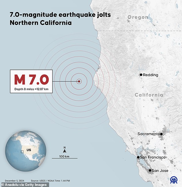
As Californians rushed for cover during a magnitude 7.0 earthquake that struck the northern region on Thursday, the United States has endured even stronger earthquakes throughout its history.
The largest earthquake ever to hit the continental US struck the Cascadia subduction zone, a fault off the Pacific coast in the Pacific Northwest, on January 26, 1700.
This earthquake, estimated at a magnitude of between 8.7 and 9.2, triggered a tsunami that hit the west coast of North America and even reached the shores of Japan.
The National Weather Service issued a tsunami warning for the West Coast following Thursday’s earthquake, but the warning has since been canceled.
While the California earthquake ruptured water pipes, shattered windows, and left more than 10,000 residents without power, it pales in comparison to many seismic events in American history.
Oral accounts from Native American tribes on the coast of Vancouver Island in the 1700s describe an earthquake and tsunami that wiped out all low-lying settlements.
The only survivors were those who lived at least 75 feet above the waterline.
A magnitude 7.0 earthquake struck off the coast of Northern California on Thursday, with the epicenter located in Humboldt County, but California and the rest of the U.S. have seen larger earthquakes.
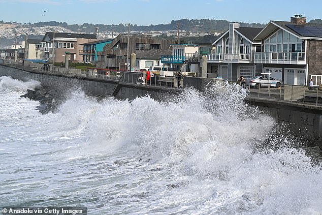
The National Weather Service had issued a tsunami warning for the West Coast following Thursday’s earthquake, but it has since been canceled.
Another devastating period of seismic activity occurred 115 years after the Cascadia earthquake of 1700, when the New Madrid Fault Zone unleashed its fury on the Midwest.
This fault zone extends 150 miles and crosses parts of Arkansas, Illinois, Indiana, Kentucky, Mississippi, Missouri and Tennessee.
In 1811 and 1812, it produced a trio of powerful earthquakes (magnitudes between 7.5 and 7.7) that shook the central Mississippi River Valley.
Historical records indicate that between 100 and 500 people lost their lives throughout the year.
As California assesses damage from Thursday’s magnitude 7.0 earthquake, the state previously experienced a magnitude 7.9 event hundreds of years ago: the 1857 Fort Tejon earthquake.
Fort Tejon, California, a former US Army outpost active intermittently between 1854 and 1864, was occupied at the time of the earthquake.
The violent tremors lasted between one and three minutes and caused significant material losses.
Two buildings were declared unsafe, while three others suffered significant damage but were still considered habitable. Several others suffered moderate damage.
One person died when an adobe house collapsed in nearby Gorman.
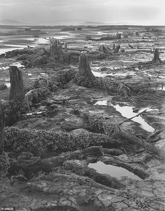
This earthquake had a magnitude of between 8.7 and 9.2 and caused a tsunami that hit the west coast of North America and the coast of Japan (pictured)
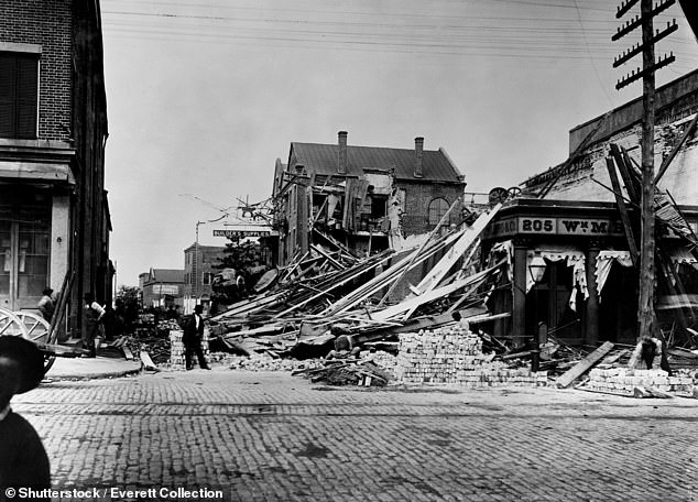
The largest earthquake in United States history occurred in Charleston, South Carolina; The photo shows the terrible damage that occurred.
The impact of the earthquake was felt across a wide area, including densely populated cities such as Los Angeles.
In downtown Los Angeles, strong tremors were recorded that cracked some homes and buildings. However, no major damage was reported.
An elderly Los Angeles resident may have collapsed and died due to the earthquake, although the report was not officially confirmed.
Two years later, the 1873 earthquake occurred between Oregon and California.
This magnitude 7.3 earthquake cracked the ground along the trail between Crescent City and Gasquet, knocking down all the chimneys in the area.
The largest earthquake to hit the East Coast in recorded history occurred in 1886, when a magnitude 7.3 earthquake devastated Charleston, South Carolina.
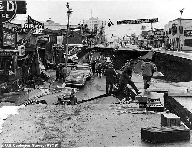
In 1964, another magnitude 9.2 earthquake struck Anchorage, Alaska. This event is known as the Great Alaska Earthquake.
The earthquake killed 60 people and caused substantial damage to nearly every structure in the city, with additional destruction reaching as far as central Ohio.
The financial cost was estimated at between $5 and $6 million at the time, which is equivalent to a whopping almost $2 billion today.
More than a century later, in 1964, a powerful 9.2 magnitude earthquake struck Anchorage, Alaska, known as the Great Alaska Earthquake.
It remains the second most powerful earthquake ever recorded in the world.
The monster earthquake hit a fault between the Pacific and North American tectonic plates, and the rupture occurred near College Fjord in Prince William Sound.
The violent tremors lasted more than four minutes, triggered multiple tsunamis and caused severe damage to property and infrastructure.
Anchorage suffered significant destruction of homes, buildings, paved streets, sidewalks, water and sewer lines, electrical systems, and other structures.
Total damage was estimated to cost more than $45 million and more than 131 people died in south-central Alaska due to ground cracks, structure collapses, and tsunamis.
Alaska frequently experiences large earthquakes due to subduction of the Pacific plate beneath Alaska, which occurs when the Pacific plate moves beneath the North American plate at a rate of two to three inches per year.

