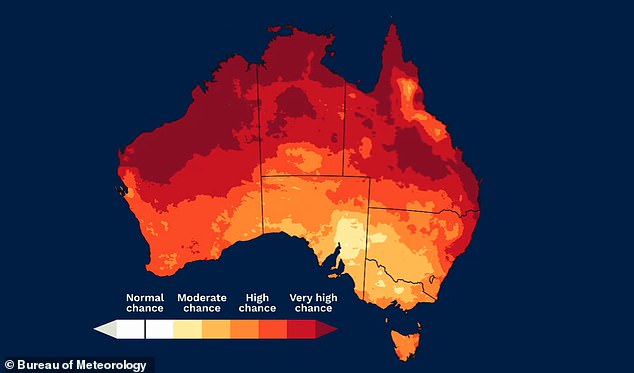
Temperatures could be “unusually warm” this autumn season, with warmer days and nights forecast for almost all of Australia.
The Bureau of Meteorology published its long-range forecast for March and May on Thursday.
Most of the country is expected to receive above-average daily high and low temperatures in the coming months.
“Australia is very likely to experience warmer than usual days and nights between March and May,” the long-range forecast said.
‘In most areas there is a greater chance of unusually warm days between March and May.
“Nights also have a higher chance of being unusually warm in many areas.”
Record-breaking global ocean temperatures are likely contributing to the forecast for warm conditions in March and May.
Temperatures could be “unusually warm” this autumn season with warmer days and nights forecast across almost all of Australia, the Bureau’s long-range forecast suggests.
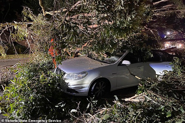
Devastating storms in eastern Victoria left up to 500,000 homes without power this week
In terms of rainfall, the Bureau said El Niño conditions would continue before the Pacific Ocean returned to neutral conditions during the fall.
Below average rainfall is likely in parts of northern Australia, including parts of northern Queensland.
In parts of western Queensland and north-west New South Wales, the weather could become even drier.
However, the Bureau of Meteorology warned that the cyclone and monsoon season coincides with autumn, so there could still be heavy rain in these areas, even if overall rainfall over the three-month period is lower than usual.
Temperatures were above average in January across most of Australia.
Weather forecast for this weekend
In the weather forecast for this weekend, WA will be sweltering with temperatures in the 30s and 40s as residents prepare bushfire survival plans.
Severe to extreme heat wave conditions are expected to develop across much of the state on Saturday, Sunday and early next week.
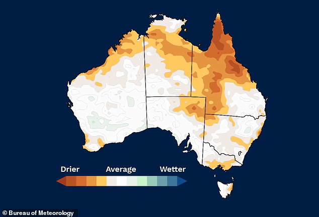
Parts of northern Australia, including parts of northern Queensland, are likely to see below-average rainfall in March and May, the Bureau’s long-range forecast suggests.
In Victoria, bushfires in the Grampian region claimed up to 25 homes on Tuesday, with the town of Pomonal receiving the brunt of the damage.
Devastating storms claimed the life of a farmer on Tuesday, and up to 530,000 homes were initially left without power during the peak of the wild weather.
As of 3pm on Thursday, the Department of Energy, Environment and Climate Action said 59,951 homes, mostly AusNet customers, were affected.
Residents in eastern Victoria will continue clean-up efforts this weekend, with firefighters hoping to extinguish fires before warm conditions return.
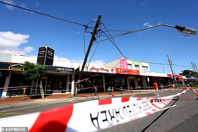
Homes and businesses still without power after storms topple transmission towers
Meanwhile, Queenslanders are bracing for another possible cyclone as forecasters monitor a tropical low in the Gulf of Carpentaria that could become a cyclone on Thursday or Friday.
A cyclone warning has been issued for communities from Port Roper in the Northern Territory to Burketown in Queensland.
It will be the third cyclone to hit the Sunshine State this summer.
Even if a cyclone does not develop, residents have been warned to prepare for heavy rain and damaging winds.
In Brisbane, skies over the city will partly clear on Saturday before showers are expected to return from Sunday.
Further south in New South Wales, a severe thunderstorm warning was issued on Thursday night for areas near Tamworth, Bourke, Walgett and Dubbo.
Damaging winds and heavy rain were expected to hit the affected areas and Sydney would also receive one or two showers overnight.
The rest of the week in Harbor City looks equally gray with rain forecast over the weekend and into the middle of next week.
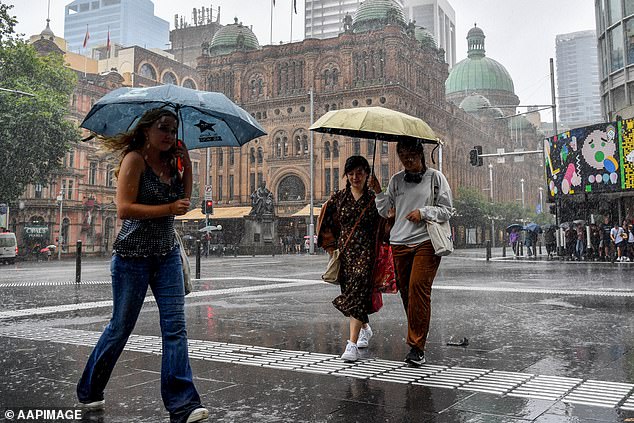
The rest of the week looks gray in Sydney with rain forecast over the weekend and into the middle of next week (pictured, people sheltering from the rain)
Melbourne is forecast to see clear, sunny skies on Thursday before partly cloudy conditions cover the city from Friday.
Maximum temperatures will remain around 20°C.
In Adelaide, temperatures have continued to rise until the end of the week.
A maximum of 28°C on Thursday will be followed by 31°C on Friday, 33°C on Saturday and 35°C on Sunday.
High temperatures will be accompanied by clear and sunny skies.
Canberra will be hit by a possible storm on Saturday and Sunday with temperatures set to remain high, with highs of 30C.
Cloudy skies over Hobart are forecast to remain into next week.
Maximum temperatures in the city are expected to remain around 20°C, while minimum temperatures remain between 10 and 10°C.
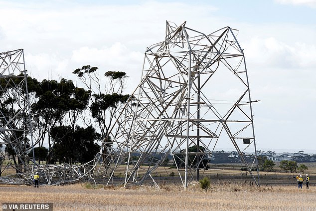
Workers are seen inspecting a damaged transmission tower at Anakie in Victoria on Tuesday.
In Darwin, storms fueled by a developing tropical low that has formed over the top end of the Northern Territory will continue on Friday.
Tropical Low 07U is forecast to bring strong winds and heavy rain to the southern Gulf of Carpentaria.
The next tropical cyclone to be declared in Australian waters will be named after Lincoln.
’07U is expected to move slowly and develop further on Thursday and Friday with an increasing risk of becoming a tropical cyclone,’ the Bureau said.
‘On Friday 07U it is likely to move southwest to the Gulf Coast and then be inland and weaken on Saturday.
“Even if it does not become a tropical cyclone, parts of the Gulf of Carpentaria coast could experience strong or gale-force winds and heavy rainfall.”
Darwin will receive showers and a possible thunderstorm on Friday, with wet conditions continuing throughout the weekend and into next week.

